


Lidar Applications
Recent developments in the use of airborne sensors and geodata processing applications have led to the creation of new types of cartographic and spatial data, which allow for innovative solutions ensuring collection speed and superior quality of spatial information.
Using the existing equipment (aircrafts and airborne sensors and cameras), as well as the broad experience in the collection, processing and management of spatial data, Geomatics offers ground-breaking solutions based on the use of airborne sensors:
Laser Scanning
-
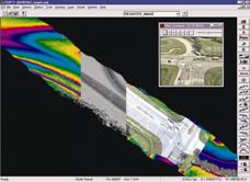
LiDAR (LIght Detection And Ranging) technology allows for the collection of high density and high accuracy elevation data using laser-beam scanning techniques. This method of producing elevation information is ideal for the scanning of both terrain and vegetation under any kind of weather conditions.
LIDAR Applications
- Production of Digital Elevation Models with densities of up to 4 points per square meter.
- Forested area mapping, identification of vegetation height.
- Production of Digital City Models for telecom networks and GIS applications. High accuracy 3D models for flood simulation, as well as noise and pollution distribution in urban areas.
- Digital Elevation Models for use in construction and mining (road and railroad network projects, large scale earthwork, surface mines) assisting in volumetric calculations.
- Rapid coastal area mapping, coastal erosion mapping and change detection.
- Flooded area mapping - Flood simulation using high accuracy DEMs.
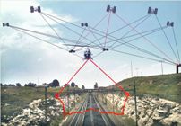
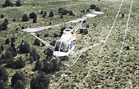
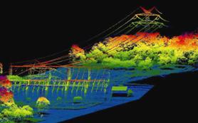
- High-voltage power line corridor mapping, with precise location of lines and towers. Surrounding area visualization for the verification of clearance from the vegetation canopy.