


Aerial Photography
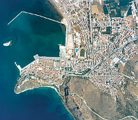
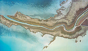
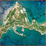
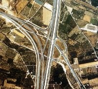
Aerial photography occupies a special position among the rapidly developing technologies in the field of spatial data collection, being the highest resolution and precision primary data collection method. Through analytic and / or digital photogrammetry, aerial photography is transformed into accurate topographic backdrops or orthophotomaps, which are essential in the planning and implementation of every infrastructure project.
Aerial photography is a crucial link in the chain of production of cartographic backdrops and georeferenced information and therefore, Geomatics has made large scale investments in this area, both in aircrafts and photographic equipment and is currently the largest Greek company in aerial photo acquisition and processing.
With over twenty years of experience, the company owns and utilizes two twin-engine aircrafts, specially modified for vertical aerial photography and equipped with the latest navigation and control instruments.
The photographic equipment consists of high-end systems from CARL ZEISS (RMK TOP) equipped with Forward Motion Compensation (FMC) and T-AS Gyro Stabilized and Suspension Mount.
The planning of the photographic missions and the acquisition of the aerial photos are fully controlled by computer processes. The project design and mission simulation are carried out within G.I.S environment, using digital maps and Digital Terrain Models (DTMs). Advanced aerial photography techniques are implemented during the flying mission, using kinematic GPS, portable computers and specialized Flight Management Systems.
Our aircrafts constantly realize flying missions, covering the entire country, either contracted by the public sector and private clients or simply in order to enrich our own database.