


Lidar Systems
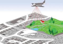
Airborne Laser Systems are direct remote sensing systems providing high accuracy elevation measurements which after post processing derive to precise Digital Terrain Models. Airborne laser sensors have the capability to measure a huge quantity of points providing point clouds of high density in a very fast way. The density and accuracy of the measurements depend on the client's requirements αnd σpecifications. Now days airborne laser sensors are able to provide points densities up to 50 points per m2 (for low altitude flights) while for majority of applications a density of 1 to 5 points per m2 is sufficient. Terrain characteristics play also an important role for the selection of the proper planning , accuracies and density.
Combined with medium format digital cameras the systems allows simultaneous acquisition of elevation measurements along with high resolution digital images allowing production of digital orthophotos.
Geomatics uses the top quality Leica ALS 60 system which represents one of the most advanced systems today operating up to ,,, KHz alllowing poind cloud densities up to ,,, points per m2 and accuracies equivalent to scale 1:500.
Applications:
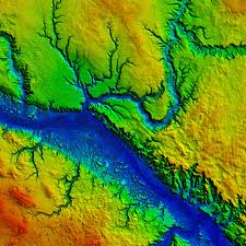
- Production of Digital Elevation Models.
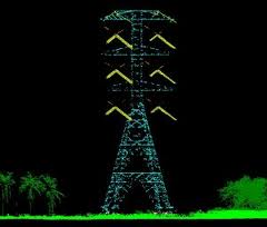
- Survey and 3D modelling of high voltage power lines
- Survey and 3D modelling of railroads and highways
- Production of 3D City Models - Applications in telecoms and noise propagation.
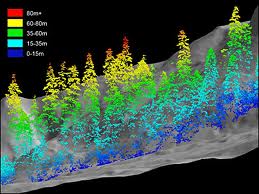
- Forestry - Creation of surface models, Measurement of canopy heights.