


Land Surveying

Land Surveying division in Geomatics covers company's needs in traditional surveing as well as in supporting ground control tasks in the framework of photogrammetric mapping, orthophoto production and geographical data collection.
We dispose up to date equipent and instruments which includes:
-
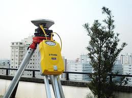
GPS receivers (double frequency L1, L2) of geodetic accuracy, type TRIMBLE and LEICA.
-
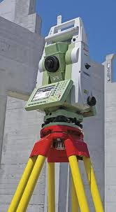
Geodetic total stations in several levels of accuracy, medium and long range, type LEICA, with capabilities of reflectorles measurements.
-
Electronic levels, type LEICA
-
Digital and analog theodolites
-
Analog leveles for high precision measurements with Invar rods
-
Auxiliary equipment for for land surveying and measurements
For processing and adjustment of geodetic networks as well as compilation of topographical diagramms we use contemporary software tools for calculation and adjustment of geodetic networks (Trimble Geomatics Office και Leica Geoffice), CAD software in Autodesk Autocad and Microstation environment as well as in house developed application on ArcGIS platform.