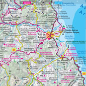
Design and Production of Tourist Maps
Utilizing the large volume of geographical data in our company. we design and produce tourist maps at a city, municipal or regional level.
We compile and process geographical data in a G.I.S environment producing maps structured in layers of information both, in geometry (road network, hydrography, populated areas) and in thematic information (points of interest, tourist information)
We produce maps which respond to strict topographical specifications and delivered in several systems of coordinates (HGRS 87, WGS 84) in order to be compatible with GPS receivers.
Our maps are available in several formats, suitable for DTP applications. Regardless your needs, whether you are looking for a city map or a map at municipal or regional level we can provide the product you are looking for in a very short time.
Contact us for further information.


