


OrthophotoMaps-DTMs-DSMs
Digital Orthophoto maps constitute a contemporary mapping product, which combines the metric quality and accuracy of a topographic diagram and the volume and quality of information provided by a high resolution digital aerial photograph.
The production of digital orthophoto maps has been made possible during the last few years as a result of the rapid development of computers and the increase of their computing power, as well as the development of the proper software products.
We are able to immediately produce high quality color orthophoto maps of every part of the country, using either the existing aerial photographs or new ones, by realizing aerial photograph acquisitions according to the clients' needs and demands.
The company's orthophoto maps' archive covers, among others, the following areas:
- Attica Prefecture - Color and B/W orthophoto maps at a scale corresponding to 1:5.000 and spatial resolution (GSD) of 0.50 m & 1.0 m.
- Thesaloniki Residential Complex - Color and B/W orthophoto maps at a scale corresponding to 1:5.000 and spatial resolution (GSD) of 0.50 m and 1,00 m.
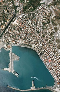
- Prefecture Capitals - Scale corresponding to 1:5.000 and spatial resolution (GSD) of 0.50 m
- Parts of the Country - Scale corresponding to 1:5.000 and spatial resolution (GSD) of 1.0 m - 1:10.000 scale and 2.0 m GSD - 1:20.000 scale and 5.0 m GSD
- Roads and Highways - 1:2.000 scale and 0.50 m, 0.25 m GSD, 1:5.000 scale and 0.50 m GSD
- Railway axes - Scales of 1:5.000, 1:2.000 and 0.50 m, 0.25 m GSD