


Aerial Photos
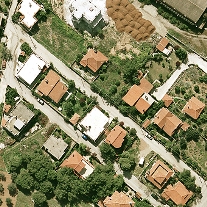
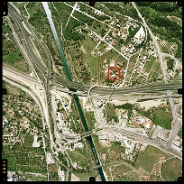
Aerial photographs constitute the raw information from which high quality and accuracy vector or raster base maps can be produced, through proper elaboration in analytical and digital photogrammetry systems.
Aerial photographs taken by our aircrafts aim to cover our clients' needs or to enrich the company's aerial photographs' archive, which currently covers cities and villages, roads, important tourist sites as well as areas of high development rate or of special interest.
We realize aerial photographs' acquisitions and we dispose of high quality, color or B/W aerial photographs at scales varying from 1:3.000 up to 1:40.000, which we process in private laboratories and transform to digital images of high resolution (of up to 5 cm on ground level), by scanning them in high geometrical accuracy and radiometric quality scanners.
We have available the following aerial photography products, in either digital or analog form:
- Aerial photography contact prints, in 23x23 cm format, color or B/W, in various scales.
- Polyester film diapositives for photogrammetric applications.
- Aerial photographs in digital form and various resolutions for common use (photo-interpretation, land use analysis, registrations )
- High geometrical and radiometric quality digital images, for photogrammetric plotting, at resolutions up to 3.500 dpi, in various formats ( TIFF uncompressed, JPEG 2000).
- Aerial photographs' enlargements in various sizes (from 2x up to 15x)
- Aerial photographs' posters of the chosen area of interest.
Coverage - Scales
- Greater Athens Region - Scales of 1:5.000, 1: 10.000, 1:15.000, 1:25.000
- Thesaloniki - Scales of 1:5.000, 1:10.000, 1:15.000 1:25.000
- Prefecture Capitals - Scales 1:5.000, 1:10.000
- Small Towns - Scale 1:8.000
- Islands - Scales 1:10.000, 1:20.000
- Roads and Highways - Scales 1:12.000, 1:15.000
- Railway Axes - Scales 1:12.000, 1:8.000